Hydrology
Interlayering of clayey till layers results in a system of layered aquifers that are not known in detail. However, some major features of the catchment’s hydrology can be inferred from merging information from different sources (Lischeid et al. 2017a). In the eastern, downstream part of the catchments streams and kettle holes are hydraulically connected to a major aquifer. That aquifer extents to the western, upstream part of the catchment as well but being disconnected from the surface by an approximately horizontal confining bed. Here streams and kettle holes (small natural ponds) are connected to an overlying shallow aquifer. Groundwater flow direction in both aquifers follows the topographical gradient, approximately parallel to the main stream (Merz and Steidl 2015, Lischeid et al. 2017a).
In general groundwater discharges into the kettle holes at one side and recharges to the aquifer at the other side. However, dense vegetation at the kettle holes’ shore, e.g., reed belts, bushes or trees, sustain high evapotranspiration even in dry periods. A model study has shown that groundwater flow direction in the “downstream” part of the kettle hole can reverse during dry periods. Depending on the texture and thickness of the shallow aquifer as well as on the meteorological boundary conditions, groundwater flow reversal can persist for some years.
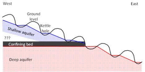
Schematic cross section of the Quillow catchment. Blue and red shading denotes the two major aquifers, separated by a confining bed in the western part of the catchment. © Gunnar Lischeid
Kettle Holes
The pleistocenic landscape in North Europe, North Asia and North America is spotted with thousands of natural ponds called kettle holes. Within the AgroSapeLab Quillow 1176 kettle holes have been identified (Lischeid et al. 2017b). Kettle holes are biological and biogeochemical hotspots. Usually they are not connected to a stream network. Typical characteristics of kettle holes like small size (<1 ha), low residence time of water within the basin, shallow depth and a high perimeter to volume ratio, indicate that they are much more intimately interlocked with their terrestrial environment compared to larger lakes. Input from the terrestrial environment occurs either by the ground-water system, by interflow, by surface runoff or by direct input via deposition or anthropogenic discharge.
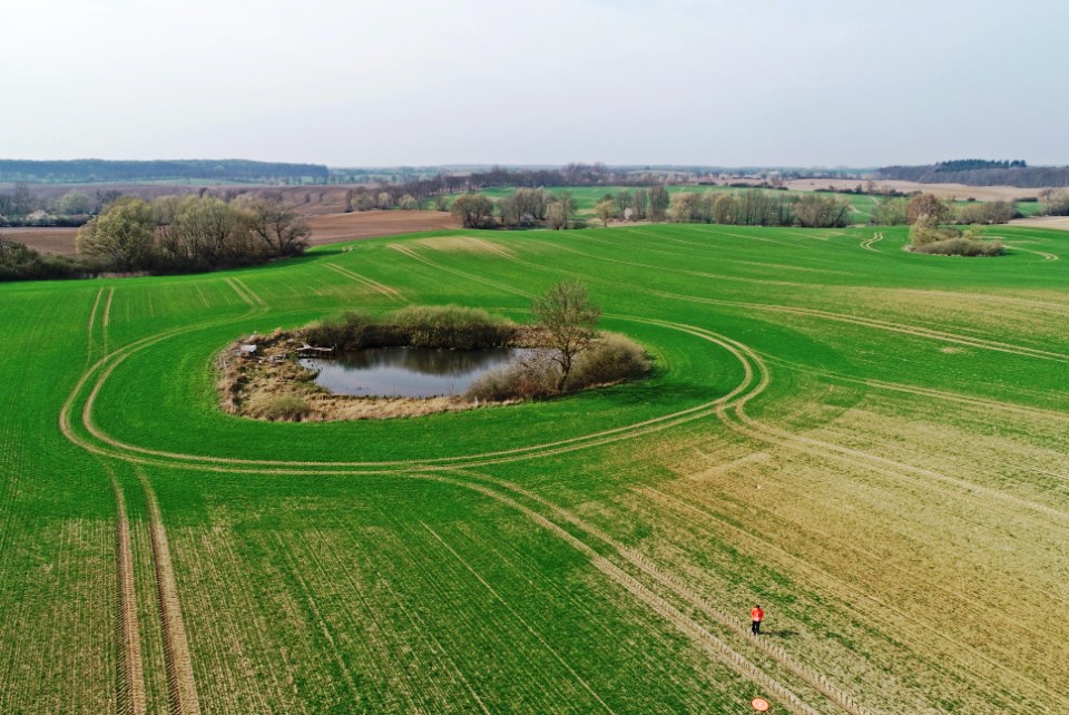
Kettle hole in the ASLQ.
© Marlene Pätzig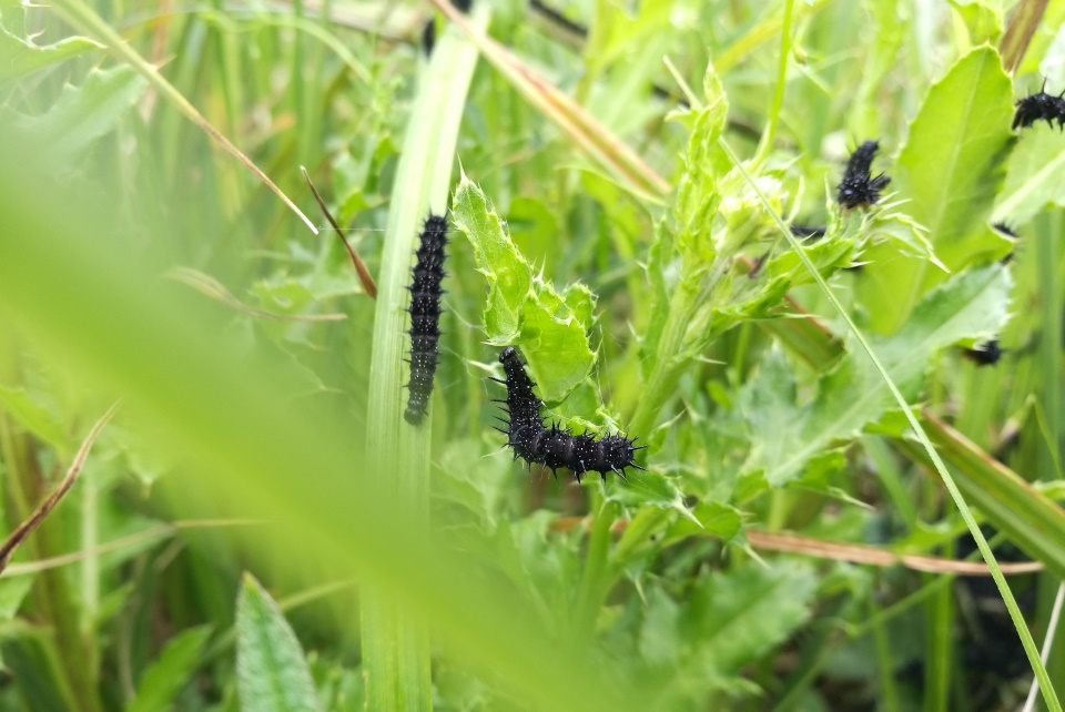
Caterpillar of peacock butterfly at the bank of a kettle hole.
© Marlene Pätzig
Kettle holes differ widely with respect to geomorphology, vegetation and hydroperiod (Kalettka and Rudat 2006). In addition they usually exhibit very rapid kinetics of biological and biogeochemical processes compared to that of large deep lakes. This is especially true for most of the kettle holes in Germany and Poland which are located in regions of intensive agriculture which fosters high nutrient concentrations and thus high internal organic carbon production (Kalettka et al. 2001, Lischeid and Kalettka 2012). Kettle hole sediment cores reveal a legacy of land use effects (Kleeberg et al. 2016a) as well as high rates of carbon sequestration (Kleeberg et al. 2016b, Premke et al. 2016).
High nutrient concentration leads to eutrophication (Kazanjian et al. 2018) and as such to fast algae blooms or coverage of (floating) macrophytes (Pätzig et al. 2012). As long as not fully covered with floating macrophytes, light is penetrating down to the sediment ground stimulating benthic primary production. Denitrification and phosphorus release from the sediment during frequent periods of hypoxia obviously plays a major role but does not follow a clear seasonal pattern. In addition, frequency and duration of desiccation periods clearly affect microbiological and biogeochemical processes (Nitzsche et al. 2017, Reverey et al. 2016, 2018).
Generally, kettle holes usually exhibit enormous spatial and temporal variability of pond water quality (Lischeid and Kalettka 2012, Lischeid et al. 2017b). This is a challenge for assessing land use effects, e.g., contamination by pesticides (Lorenz et al. 2017) or the effect of mitigation measures.
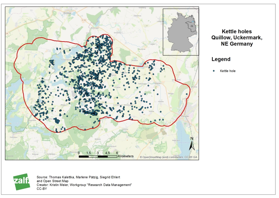
Map of kettle holes in the Quillow catchment. © Kristin Meier.
 References used in text