The AgroScapeLab comprises the Quillow catchment in Northeast Germany, about 90 km north of Berlin. The Quillow catchment has an area of about 170 km2 upstream of the confluence with the Strom stream which drains the adjacent catchment in the south. The topography is characterized by gently rolling hills, a so-called hummocky landscape. Altitude decreases from 110 m a.s.l. in the western part of the catchment, which is dominated by terminal moraines, to 20 m a.s.l. in the east, that is, the glacial valley of the receiving Ucker River close to the town of Prenzlau. The area has been used for intensive agricultural production for centuries.
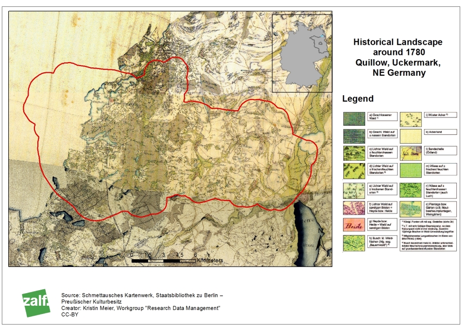
Historical Landscape of the Quillow catchment around 1780. © Kristin Meier
ASLQ as an important research infrastructure
The Quillow catchment represents an ideal case study site for agricultural landscape research on global change issues. This is due to
- (i) a productive agriculture,
- (ii) the strong E‐W gradient of rainfall and climatic water balance (= sensitivity to climate change),
- (iii) a diverse mosaic of natural and agricultural ecosystems, transition zones, rural and urban sites,
- (iv) a geomorphological landscape type (glacial drift area) being representative for 10% of arable land globally, and,
- (v) the connectivity to the Baltic Sea (land‐sea‐interactions).
Current long‐term monitoring of numerous environmental state variables and agricultural management practice (“Basisprogramm Acker”) as well as single measurements, sampling campaigns and various process studies, e.g., in CarboZALF, provide a sound basis to extend observational approaches towards experiments on the influence of land use on multiple landscape‐scale processes. The strategic importance of the ASLQ for the networking of the ZALF with universities and non-university research institutions is given, for example, in joint research activities with Helmholtz institutions in the
TERENO initiative (GFZ, UFZ, DLR and FZJ as partners in SoilCan, erosion monitoring and remote sensing), in the DFG Research Training Group "Biomove" (University of Potsdam),
LTER-D, or the Berlin-Brandenburg Institute for Advanced Biodiversity Research (BBIB).
initiative (GFZ, UFZ, DLR and FZJ as partners in SoilCan, erosion monitoring and remote sensing), in the DFG Research Training Group "Biomove" (University of Potsdam),
LTER-D, or the Berlin-Brandenburg Institute for Advanced Biodiversity Research (BBIB).
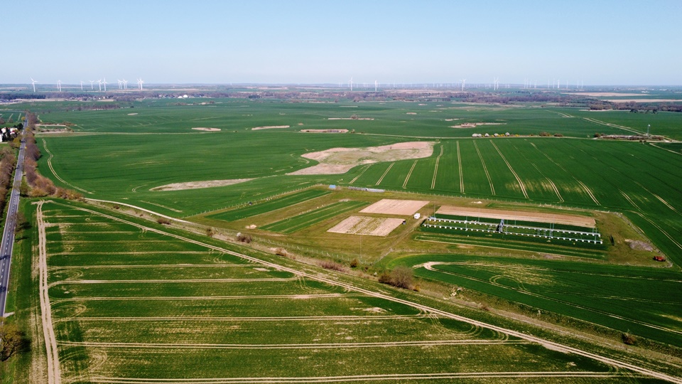
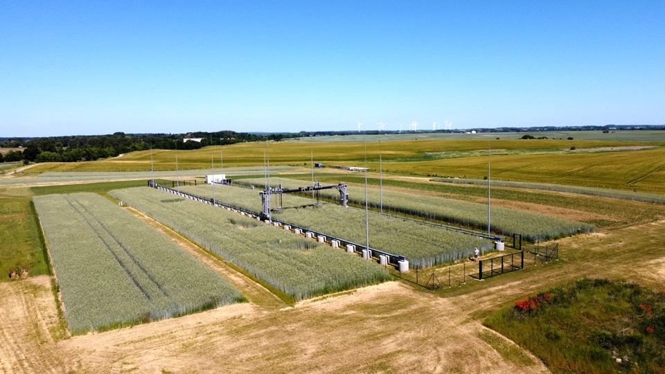
Experimental site with gantry crane system located in Quillow catchment. © Marten Schmidt