Geology
The landscape of Northeast Germany has been massively reshaped during repeated advances and retreats of glaciation during the Pleistocene. This resulted in a complex setting of unconsolidated sediments with high textural heterogeneity. The sediments form a series of layered Pleistocene and Tertiary aquifers of about 100–150 m thickness with a 50-m-thick Oligocene marine clay layer as a lower confining bed. The complete series consists of permeable marine dominated sediments of upper Oligocene and the lower Miocene with a complex interplay between glacial deposits of the Pleistocene with a vertical extent of more than 100 m. These deposits, dominated by sediments from the main glaciations (Elster, Saalian and Weichselian), can be divided into different aquifers separated by till layers.
Topography and the related stream network are still far from maturity. Besides some large lakes, numerous small lakes and wetlands developed in drainless depressions. These natural ponds (<1 ha area each) are called kettle holes (Kalettka and Rudat 2006).
Soils
The soil pattern of the Quillow catchment is related to topography and the heterogeneity of Pleistocenic deposits. Since the last centuries the natural soil pattern has been strongly modified by soil erosion (tillage, water) (Sommer et al. 2008, Gerke et al. 2012, Gerke et al. 2016, Koszinksi et al. 2013). Recently, only 20% of the arable land shows non-eroded soils (Albic Luvisols), mainly at lower midslopes. Extremely eroded soils (Calcaric Regosols) occur at convex landscape positions as well as steep slopes and strongly eroded soils (Calcic Luvisols) reaches from hilltops to upper midslopes. Footslopes and closed depressions comprise 20% of the landscape. Here, groundwater-influenced colluvial soils (Gleyic-Colluvic Regosols, partly overlying peat) have developed. Generally, the soil landscape reveals strong local gradients in wetness (at < 100m distance). The soil texture is mainly loamy sand to sandy loam.
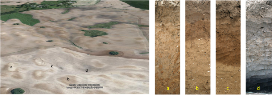
Erosion-affected soil pattern in the Quillow catchment: Light colours at hilltops indicate extremely eroded soils (a: Calcaric Regosols) by tillage erosion; brownish colours represent strongly eroded soils (b: Calcic Luvisols) affected by both, tillage and water erosion; bright colours at lower midslopes indicate non-eroded soils (c: Albic Luvisols) and dark greyish areas indicate groundwater-influenced colluvial soils (d: Gleyic-Colluvic Regosols) in closed depressions. © Michael Sommer.
Land Use
Land use is dominated by agriculture which covers about 74% of the catchment area where arable fields prevail. Grassland is found mainly close to the Quillow stream and in the eastern lowland parts of the catchment. In addition, small forest patches are located mainly in the western and southwestern part of the catchment. There are no major settlements in the catchment except for some small villages and single houses. Both settlement density and intensity of agricultural production have been rather stable over the last two decades.
Due to more fertile and less sandy soils compared to other regions in Northeast Germany this region has been intensively used by agriculture for centuries. However, a closer look at historical maps and reports revealed substantial changes at smaller spatial scales that are reflected in vegetation patterns until today (Wulf et al. 2016, 2017).
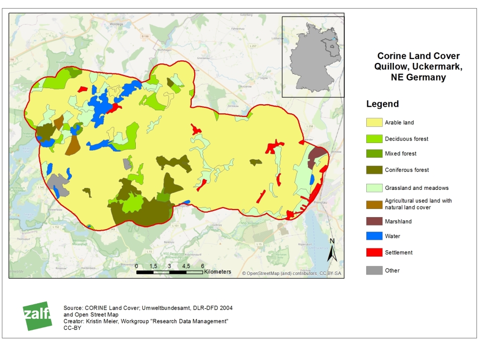
Land use in the Quillow catchment. © Kristin Meier.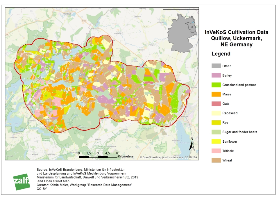
Cultivated Crops in the Quillow catchment in 2019. © Kristin Meier.
 References used in text