Daten
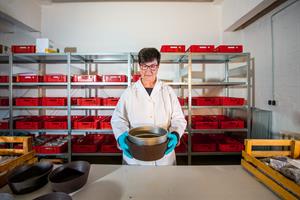 Bodenprobenlager im Zentrallabor, ZALF, © Jarno Müller/ZALF
 patchCROP zeichnet sich durch eine Vielzahl gemessener Parameter mit unterschiedlicher zeitlicher Auflösung aus, die in den wissenschaftlichen Disziplinen Pflanzenphysiologie, Pflanzenschutz, Bodenfruchtbarkeit, Biodiversität, Fernerkundung, Betriebsökonomie und Modellierung auf patch, Feld- und Landschaftsebene erhoben werden.
Die fachübergreifende Datensammlung erfolgt seit März 2020, ist kontinuierlich für die Dauer der Projektlaufzeit geplant und wird sorgfältig in einem Datenmanagementplant erfasst und überwacht. In regelmäßigen Abständen werden erhobenen Datensätze im BonaRes Datenrepositorium veröffentlicht.
Bereits erhobene Informationen (Stand Mai 2021)
Plot / Patch Level
Agronomy: plant height, plant growth stage, NDVI, leaf area index, biomass (and nutrient content N, P, K), harvest (and grain nutrient content N, P, K)
Soil science: LoRa-WAN based soil sensor network for soil moisture, soil temperature and electrical conductivity; soil organic matter composition, earthworm density and species and mineral decomposition rates, soil infiltration rate (Hood infiltrometer), bulk density, soil texture, carbonates, nutrients (mineral N, total N, SOC, K, Mg, P), soil pH, visual evaluation of soil structure, soil aggregate distribution by wet and dry sieving
Biodiversity: wildflower species composition in flower strips
Crop protection: digital yellow traps, pest incidence, pathogen incidence
Operational data: planting, fertilization, pesticides, tillage, work hours
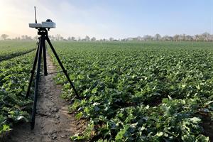 Messung des Blattflächenindex mit einem SunScan (Delta-T Devices)-Beam Fraction Sensor, © Clara Heilburg
 Field Level
Agronomy: Yield maps, Fixed-Wing Ebee UAV with 2D and 3D RGB camera, multispectral camera, thermal camera
Soil science: erosion elevation model, EM38 soil scanner-apparent electrical conductivity
Operational data: precipitation, air temperature, radiation, wind speed, photosynthetically active radiation
Agricultural Landscape Level
Agronomy: SIMPLACE Modelling, Sentinel and Landsat images
Soil science: digital elevation model, Geophilus soil scanner- electrical bulk resistivity, Veris Multisensor platform- apparent electrical conductivity (ECa), soil pH, reflectance measurements by OpticMapper at 660 nm (red light) and 940 nm (NIR)
Biodiversity: ground beetle species, spider species, bird monitoring
Crop protection: weed pressure, pest and disease incidence
Operational data: crop management activities of neighbouring fields, permanent traffic lines with controlled field movement and sampling locations